Despite the facilities provided by the digital era allowing us to shorten distances, there are trips that, if they can be made, provide much more in terms of the experience and the exchange of knowledge with the locals. And our trip to Galicia was one of them…
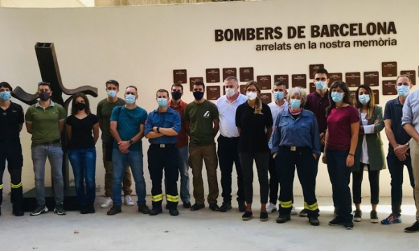
It was October 2021 and part of the TEP team - Mercedes, Robert, Victor and Borja - travelled to Galicia with the aim of collecting case studies, to work alongside the team of Galicians, leaders in innovation and training in Galicia, located in Ourense, to visit wildfire sites with them, to learn and understand how wildfires move in their environment and how firefighting is carried out in the Galician community.
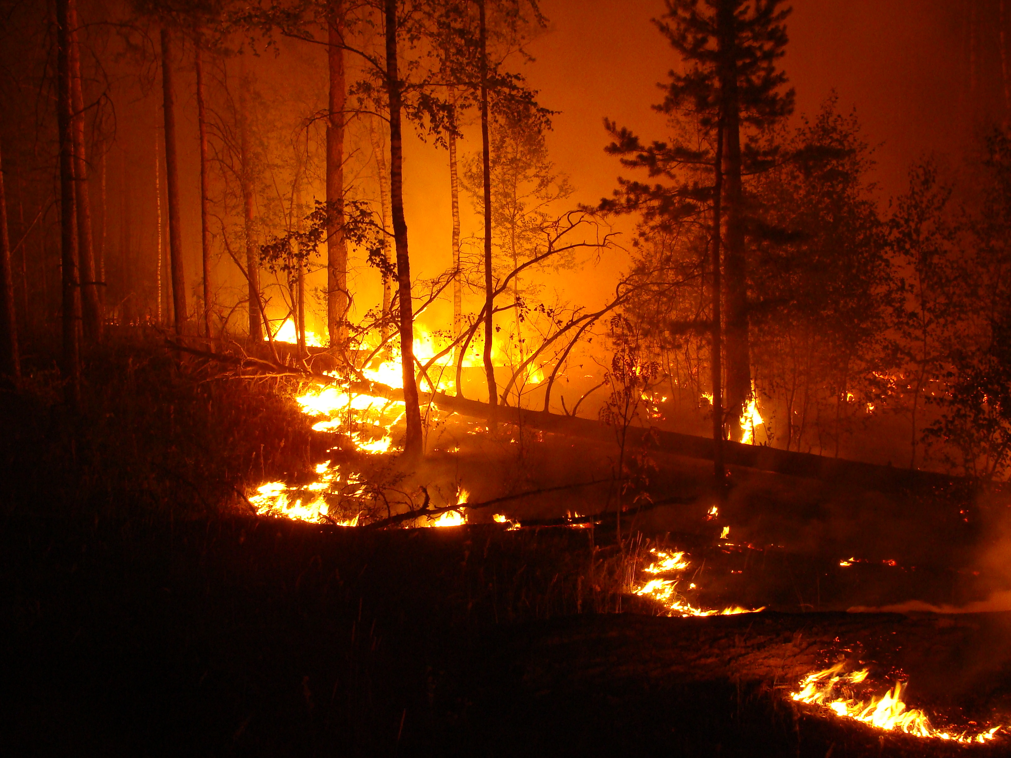
We visited recent and relevant wildfire sites because of their different behaviours and patterns. The Galicians quickly knew which wildfires to tell us about... an easy-to-understand convective (plume-driven) wildfire: Toén 2020; a wind-driven wildfire: Ribas de Sil 2021; and a terrain-driven wildfire: Lobios 2020.
Toén wildfire (2020)
We started with a tour of the terrain and the wildfire perimeter, and then moved on to the recording of the lesson. San, one of our trainers (www.emerprogram.com/equipo), told us all the fire dynamics, which allows us to generate a lesson in TEP style: the initial analysis and the operations that were carried out. The Toén wildfire, or Moreiras, started as a topographic wildfire displaying convective moments. After reading the work window, San explained how the tactical analysis is done in Galicia and what operations are mainly used to meet the tactical objectives that have been identified.
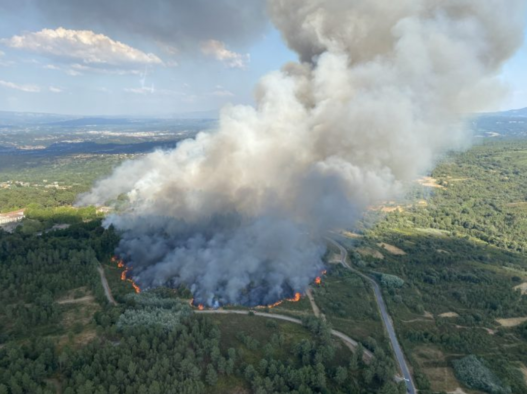
Pic 1- Moreiras wildfire behaviour before its head is aligned wind+slope
Thanks to San's detailed report, being able to be on site and working with the Galician team on the analysis of potential polygons and fire connections, we were able to enrich the post-editing process, resulting in a TEP lesson with the analysis of this fire. In this lesson, we can see the priorities and how the operations carried out had an impact on the reduction of potential damage, using the aforementioned methodology.
Ribas de sil wildfire 2021
The next wildfire that we visited was a recent one, which had taken place the previous month. It was a wind-driven wildfire, produced by curious simultaneity within the same valley. This wildfire was able to jump the river Sil and spread rapidly towards the north.
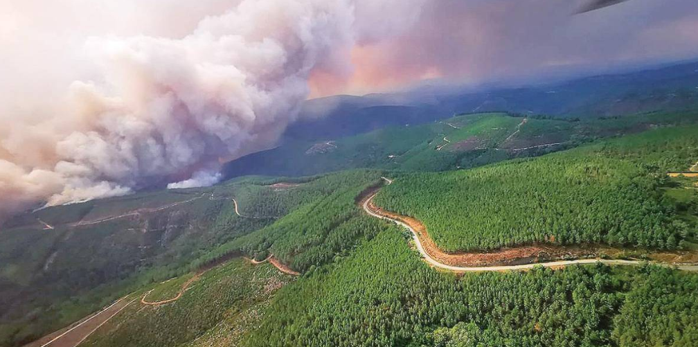
Pic 2- Ribas de Sil wildfire, after having jumped the Sil river. It spread freely and completely aligned with the wind along the right side of the valley overlooking it, with multiple secondary spot fire outbreaks at short distances.
There is a whole lesson about this wildfire in TEP and how it was approached from the very beginning: the explanation of the fire window, the main movements it made and the reading of priorities. Also, after an exhaustive analysis, in the lesson we develop the analysis of potentials and how we use it to decipher the priorities of work on the fire... so that it cannot jump rivers nor roads that are key to contain it and so that it does not open up new potentials.
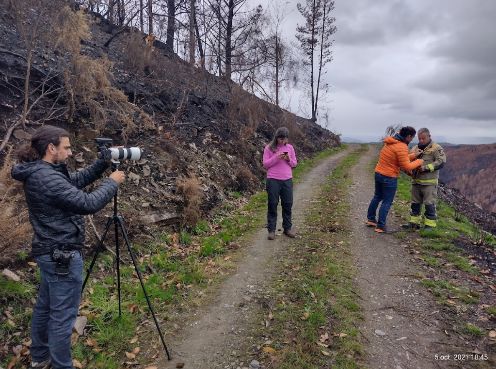
Pic 3- Filming session of the Ribas de Sil wildfire lesson.
Lobios wildfire 2020
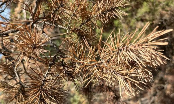
Finally, we had the opportunity to visit the Serra da Estrela, where wildfires happen very frequently and are generally topographic/terrain-driven wildfires that spread through the abrupt terrain with little access.
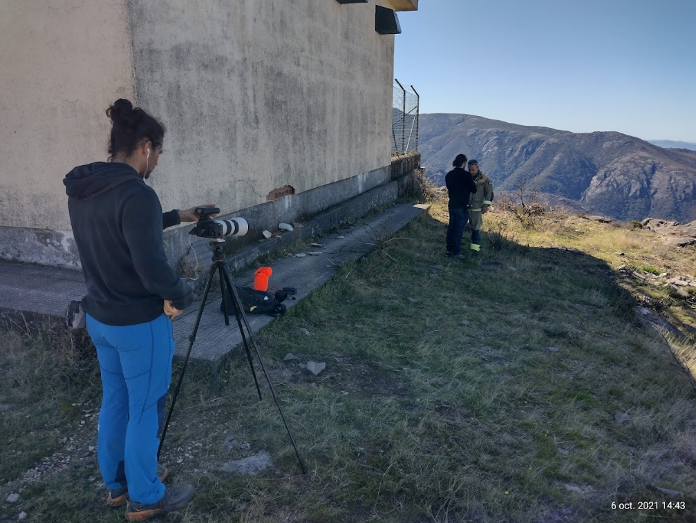
Pic 4 - Filming session with Pablo Hermo in the highest part of the Lobios wildfire site.
This time, it was Pablo Hermo who told us in detail about the Lobios fire in 2020 where, thanks to the vision of the operative, they managed to close the right flank that could have opened up a potential of 3000 ha from the beginning, if it had managed to cross the valley or even reach the valleys confluence from its tail - right flank. In this lesson, we show in detail how we convert into tactical potential polygons, the different steps that the fire makes and movements that the fire can make over the terrain, following a topographic pattern. In addition, we show how we subdivide the drainage basin where the wildfire is located into potential polygons and how we represent the connections that indicate the probability of the fire passing through the scenario.
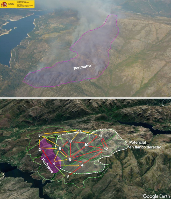
Fig 5 - Aerial image of the Lobios wildfire perimeter, analysis of potential polygons and probability of fire passage connections. This analysis allows us to unmask the maximum potential and now how the fire can achieve it. As can be clearly seen, the access to the maximum potential is in the gullies on the right flank.
This right flank can be clearly seen, but if we apply the polygon method, it is even clearer: the priority to limit spreads and entry into new gullies as much as possible is to take advantage of the first opportunity presented by this right flank.
NE wind driven wildfires on Galician west coast
Although we were able to document these three high quality case studies, our stay in Galicia was not over yet. There are three cases covered in detail in videos for TEP, both in behavioural analysis, as well as in strategic and tactical analysis, explaining and describing in detail even the key operations regarding the most important tactical objectives.
But we wanted to go a step further and visit the simultaneous scenarios of the large wildfires of 2006. To do this, from Ourense we had to travel to the area of Pontevedra to appreciate which landscapes the wildfires from this episode were moving on. Prior to this trip, we had to determine which wildfires are threatening the area, i.e., which are the target wildfires for the coastal area of Pontevedra.
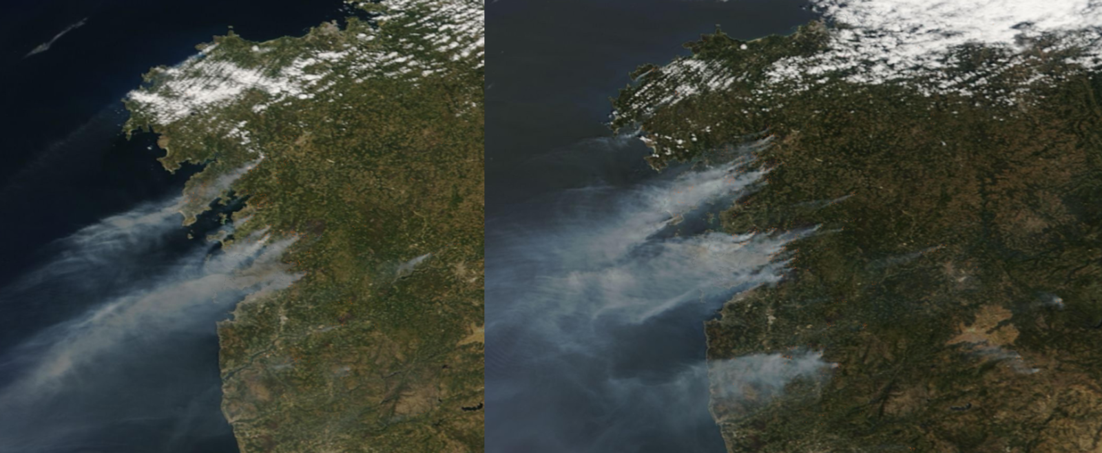
Pic 6 - Simultaneous wildfires in the Pontevedra area under a northeasterly wind situation. Situation on the 7th and 8th of August 2006. Source: (Terra/Modis) Nasa World View.
If we analyse historical perimeters and big events, being at that time, the biggest and closest in that area to the episode of 2006, we can see that the mountain ranges that go towards the coast follow a NE-SW direction. In addition, when there are north-easterly winds in the entire western part of Galicia, we have fast spreading wind-driven wildfires with all the macro-topography aligned.
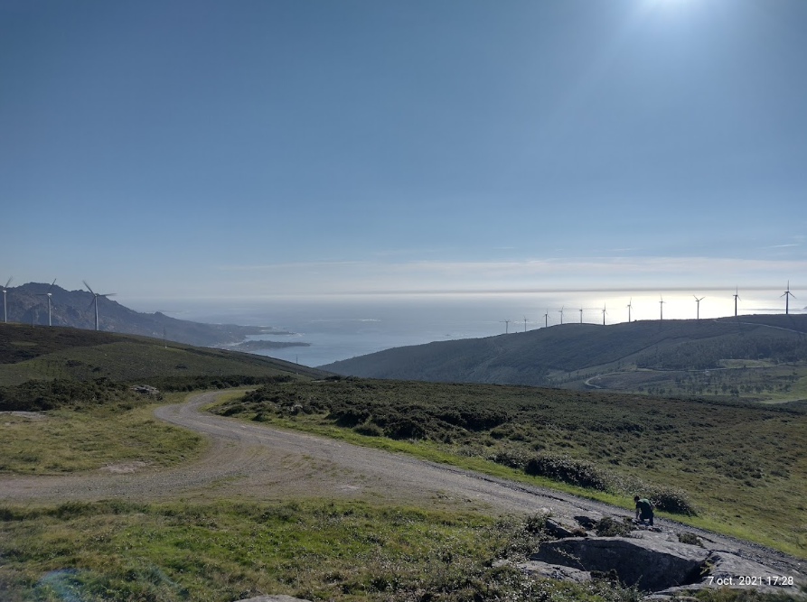
Pict 8 - Landscape of the ridges aligned with the NE wind and its descent to the sea. It can be seen that nowadays they are fuels that in situations of availability can generate extremely fast spreading fires.
The aim is to understand the landscape and learn, using the polygon of potential methodology, to find the common points that the Galician landscape has, which causes fires to grow, that is, we want to learn by testing a method and a tool in the Galician landscape, together with its technicians, and to introduce the SMP (strategic management point) method, which was born in Catalonia. Understanding the macrotopography, understanding how they spread, and understanding the fire model and the pattern that makes them really fast spreading wildfires and out of suppression capacity, we can draw a large grid of potential polygons, which will allow us to find the opportunities to let the fires burn to the sea in the narrowest possible way.
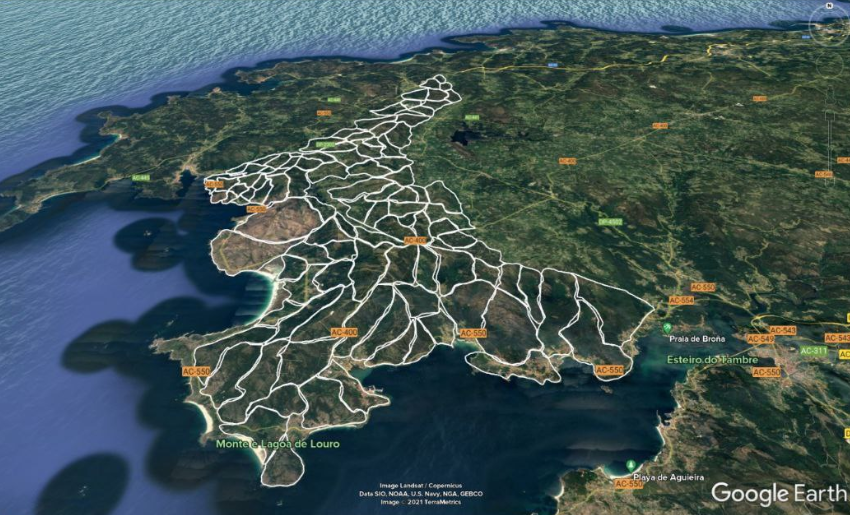
Pic 9 - Example of a macro polygon grid to work in detail and find points and areas of opportunity to narrow wildfires with NE wind projection.
From this trip, one of the great final theoretical-practical exercises in TEP Advance was born (more information: www.emerprogram.com/programa/iiff-advance). At the end of the course an exercise is proposed where, after understanding the key points mentioned previously, a strategic and tactical analysis must be carried out to achieve a resolution scenario that maintains a narrow fire until it loses its ability to spread towards the sea, defending the urbanisations and villages that may be found in its path with a NE wind.

Pic 10 - Fuel models and detail of the macro-topography with the ridges aligned NE to the Atlantic Ocean.